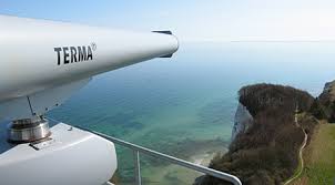
Coastal Surveillance Systems

Coastal surveillance systems are used to provide both Vessel Traffic Services (VTS) as well as Security Surveillance. With increasing amounts of coastline, territorial waters and Exclusive Economic Zone (EEZ) to be monitored and managed for security, environmental protection, and safety, the ideal coastal maritime surveillance system will compile a real-time Traffic Image/Common Operating Picture and highlight vessels of interest without undue operator involvement, to reduce operator workload.
Vessel Traffic Services (VTS) and AIS Networks
We design end to end Maritime Domain Awareness Solutions using KONGSBERG products and technology.
We provide solutions to integrate Magnetron & Solid state Radar, AIS, MBR, VOIP, VHF, DF, Meteorology/Hydrology sensors, SCADA and microwave links.We execute above mention jobs thorough our group companies.
A Coastal Vessel Traffic Service (VTS) system coupled with an AIS Network helps ensure the safety and efficiency of ship traffic through high-risk areas such as Traffic Separation Schemes, and restricted areas.
We provide the necessary tools for:
- Quickly and efficiently capturing ship information
- Complying with IALA VTS Recommendations
- Dynamically assessing marine risk
- Monitoring speed related to CO2 emissions
- Enhancing environmental protection through reducing groundings and oil spills
- Coordinating Search and Rescue (SAR) operations
- Establishing a Maritime Operations Service
Surveillance and Security
Our Surveillance Systems create the real-time Common Operating Picture by providing detection, classification and identification of cooperative and non-cooperative vessels so that reaction assets can be tasked. As threats approach the coast, it is essential to present land-based quick reaction forces with the maritime picture so that reaction efforts can be coordinated.
Our Coastal Surveillance Systems provide coastal authorities with the ability to:
- Improve security of the maritime domain and coastline
- Detect vessels at long ranges
- Identify and classify vessels
- Highlight vessels of interest
- Visualize land-based reaction forces with the maritime picture
- Prevent ships from entering dangerous, sensitive, prohibited or restricted areas
- Prevent illegal immigration, drug trafficking and smuggling
- Detect oil spills with radar and/or satellite images
- Coordinate Search and Rescue and oil spill clearance/containment operations
- Integrate Blue Force Tracking
Managing Data
Coastal authorities are typically tasked with collecting, storing, and retrieving information about vessels moving in their coastal areas. The C-Scope Management Information System - Coastal (CSMI) is a critical tool for managing the vast amount of data collected on a daily basis. Through our CSMI, Coastal authorities can quickly classify vessels, highlight vessels of interest, and retrieve data on any past incidents and accidents.
Note: Please click on the photo to enlarge it.